
Burnaby Lake Homes for Sale
On this page (22 sections)
- Burnaby Lake homes listed and sold, June to October 2026
- Where Burnaby Lake sits
- Drive time to Burnaby Lake
- Common questions
- Burnaby Lake by home type
- More Burnaby real estate
- Lots and land in Burnaby Lake
- What's nearby Burnaby Lake
- What's nearby, building by building
- Burnaby Lake: streets and boundaries
- Burnaby Lake: the housing stock
- Burnaby Lake: rules that affect buyers
- Burnaby Lake: local details a buyer would not know
- Burnaby Lake: development and new projects
- Burnaby Lake: costs and taxes
- Burnaby Lake: getting around
- Burnaby Lake: risks and due diligence
- How Burnaby Lake compares
- Related pages
- Sources for Burnaby Lake
- Sources
- Burnaby neighbourhoods
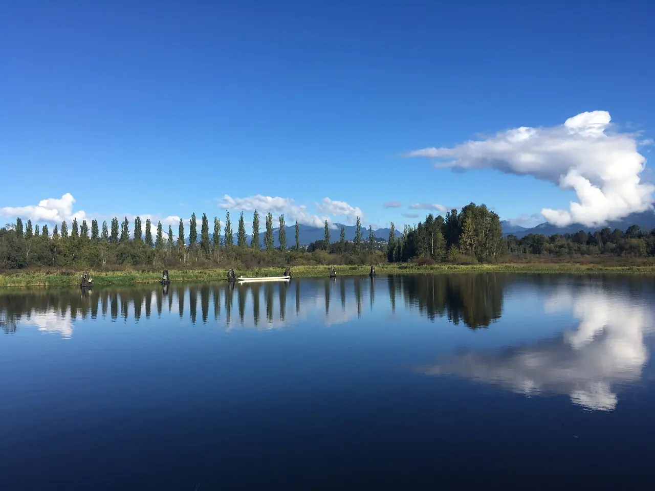
Living near Burnaby Lake means waking up to birdsong and having a regional park as your backyard. This unique residential area blends natural surroundings with suburban convenience, attracting nature lovers, outdoor enthusiasts, and families seeking a serene lifestyle.
Email me new listings for this search
The live listings did not load. Search Listings
Burnaby Lake homes listed and sold, June to October 2026
Burnaby Lake, October 2026. Detached houses: 21 listed at month end and 2 sold in October, a sales ratio of 10% (a buyers’ market). Condos and townhomes: 3 listed at month end and 0 sold in October.
Where Burnaby Lake sits
The map loads when you scroll to it.
Drag to move the map. Zoom in to show the names of smaller areas. Press an area to open its page.
Show nearby places
Drive time to Burnaby Lake
| Month | Houses listed | Houses sold | Houses ratio | Condos and townhomes listed | Condos and townhomes sold | Condos and townhomes ratio |
|---|---|---|---|---|---|---|
| June 2026 | 24 | 1 | 4% | 6 | 1 | 17% |
| July 2026 | 23 | 2 | 9% | 5 | 0 | — |
| August 2026 | 18 | 1 | 6% | 3 | 2 | 67% |
| September 2026 | 19 | 2 | 11% | 3 | 1 | 33% |
| October 2026 | 21 | 2 | 10% | 3 | 0 | — |
Source: MLS® data from the Greater Vancouver REALTORS® and the Fraser Valley Real Estate Board, compiled by SnapStats®. How these figures are defined and sourced
Looking across the period, Detached houses: 8 sold over 5 months against an average of 21.0 listed, about 13.1 months of listings at that pace; the busiest month was July with 2 sold. Condos and townhomes: 4 sold over 5 months against an average of 4.0 listed, about 5.0 months of listings at that pace; the busiest month was August with 2 sold.
Common questions
Can I buy a vacant lot on Burnaby Lake?
No known one — the lake itself is a 360-acre regional park, and the surrounding streets are built fee-simple house lots.
Does a park-edge home come with lake frontage or dock rights?
No — the park is public land managed by Metro Vancouver under a 25-year agreement; a home borders or overlooks the park, it does not come with lake frontage rights, and the park's wildlife rules are part of living there.
How many units can a house lot here hold?
Under the R1 SSMUH rules: 3 units on lots up to 280 m², 4 units on larger lots, and 6 units on lots of at least 281 m² within 400 m of a frequent-transit stop — Sperling–Burnaby Lake Station proximity is the parcel-specific question on the west side. Confirm the parcel's district and transit distance with the City.
What checks does a lake-edge lot need?
Flood, habitat and watercourse-setback checks, early — the shoreline is protected wildlife habitat, and no floodplain designation for the residential streets was confirmed, so the position is parcel-specific.
Can I paddle on the lake from my side of the park?
Yes, from the west side. Metro Vancouver describes a rowing course with a rowing pavilion and a public canoe launch at the Burnaby Lake Sports Complex, while the former kayak and canoe launch at Piper Spit on the north shore can no longer be used because of siltation, so launch access depends on which entrance a home is near.
Which SkyTrain station serves this area?
Sperling–Burnaby Lake Station, at 2800 Sperling Avenue. It is an elevated Millennium Line station at Sperling Avenue and Lougheed Highway on the area's north-west side, you can walk into the park directly from the station, and TransLink's station map shows bus routes 110, 134 and 144 connecting there.
What is being built beside Bill Copeland Sports Centre?
A new Burnaby Lake Recreation Complex. The City states it replaces the aging CG Brown Memorial Pool and Burnaby Lake Ice Rink with a 10-lane 50-metre pool, a 6-lane 25-metre pool and an NHL-sized rink, and the City's Fall 2025 update put it at 33 percent complete with an estimated opening in 2028, so nearby streets carry construction traffic in the meantime.
Is Burnaby Lake a neighbourhood or a park?
Both names are in use for different things: Burnaby Lake Regional Park is a 360-acre Metro Vancouver regional park around the lake, managed by Metro Vancouver since 1978 under a 25-year lease agreement with the City, and "Burnaby Lake" is also the GVR MLS® sub-area name for the housing on the streets around it.
What can you do at Burnaby Lake?
Metro Vancouver describes a wildlife sanctuary with walking trails, viewing towers and docks, a Nature House, and a rowing course with a pavilion and public canoe launch at the Burnaby Lake Sports Complex; the complex itself has 5 lit artificial turf fields and 17 tennis courts in the City's listings.
How is transit at Burnaby Lake?
Sperling–Burnaby Lake Station (Millennium Line) sits at Sperling Avenue and Lougheed Highway at the area's north-west side, you can walk into the park directly from the station, and buses 110, 134 and 144 connect there — the 144 links the station to Metrotown and SFU.






















What Buyers & Sellers Say
Excerpts from Google reviews for Jared Gibbons, REALTOR® at Royal LePage Little Oak Realty (Suite 201 - 15272 Croydon Dr, Surrey). Quoted word for word; initials only.
-
5 out of 5 stars
“Jared’s commitment to customer service is top notch. He was super quick and on the ball- we would totally work with him again.”
R.S. Google review
-
5 out of 5 stars
“Amazing realtor. Jared is very professional with his clients, and has a deep understanding of the housing market to get the best value for your home purchase/sale!”
M.K. Google review
-
5 out of 5 stars
“Jared is a great guy. He stands out as an honest, hard working professional in an industry where good people are hard to find. We’ve bought and sold a few places with him…”
J.O. Google review
Burnaby Lake by home type
More Burnaby real estate
- Burnaby homes for sale
- Burnaby real estate market stats
- Burnaby condos for sale
- Burnaby townhomes for sale
- Schools in Burnaby
- Capitol Hill real estate
- Cariboo real estate
- Central real estate
- Central Park real estate
- Deer Lake real estate
- Deer Lake Place real estate
- East Burnaby real estate
- Edmonds real estate
- Forest Glen real estate
- Forest Hills real estate
Lots and land in Burnaby Lake
Fee-simple lots
- Established-street house lots
- The only sourced size figures are the R1 SSMUH thresholds in (280 m² / 281 m²), which are zoning thresholds, not a claim about any existing lot's size.
- The park is not land supply: Burnaby Lake Regional Park is 360 acres, managed by Metro Vancouver since 1978 under a 25-year lease agreement with the City signed February 2025; the lake and park lands are park and conservation land, not housing land, and a home here does not come with lake frontage rights.
- Serviced position: Burnaby's 2026 residential utility notice covers annual water, annual sewer use, a cross-connection device charge where applicable and a garbage toter fee, with the detached single-family water charge at $652.33 and sewer for single-family homes billed as a sewer parcel tax — the established streets sit inside that municipal system on the City's wording.
- ALR vs non-ALR: no ALR parcel in Burnaby Lake is confirmed; ALR status is a property-specific check through the Agricultural Land Commission. No ALR percentage split is stated.
Streets, schools and getting around Burnaby Lake
- Burnaby Lake is a City of Burnaby GVR board sub-area wrapping Burnaby Lake Regional Park in central-east Burnaby — residential streets on the lake's edges (Sperling/Kensington west and north-west, Government Road/Beaverbrook east) around a large regional park and lake that are not themselves residential land. Burnaby Lake Regional Park is a Metro Vancouver regional park; "Burnaby Lake" the sub-area is the housing around it.
- Nearby areas: Montecito and Sperling-Duthie north and west, Government Road east, Burnaby Hospital and Deer Lake south-west, Lougheed Town Centre further east along Lougheed Highway.
- Main roads: Lougheed Highway (north), Winston Street, Sperling Avenue, Kensington Avenue and Government Road; Highway 1 runs along the lake's south side. Transit: Sperling–Burnaby Lake Station (Millennium Line) at Sperling Avenue and Lougheed Highway, walkable into the park, with bus routes 110, 134 and 144 connecting there; route 110 runs past the lake's north and west sides between Lougheed Station and Metrotown Station.
- Nearest hospital: Burnaby Hospital, 3935 Kincaid St, immediately south-west.
- Schools: SD41 (Burnaby) — 41 elementary and 8 secondary schools city-wide, no middle-school tier (K–7 / 8–12). SD41 schools beside the sub-area on the Province's list: Sperling Elementary (K–7), 2200 Sperling Ave; École Seaforth Elementary (K–7), 7881 Government Rd; Burnaby Central Secondary (8–12), 6011 Deer Lake Parkway.
Local rules that affect land buyers in Burnaby Lake
- Lake-edge diligence: the lake shore is low, marshy wildlife habitat. For lake-edge and creek-edge lots, check flood, habitat and watercourse-setback conditions early — setback surprises surface late in deals.
- Bare-land strata rules: Form B diligence (fees, amounts owed, levies, CRF balance, insurance summary; provided within 7 days, max $35 + 25¢/page); depreciation reports on a 5-year cycle for stratas with 5+ lots since July 1, 2024; minimum 10% CRF contribution since November 1, 2023; rental-restriction bylaws void since November 24, 2022 (short-term restrictions may still apply by bylaw); only 55+ age bylaws valid under SPA ss.123.1/123.2, with May 1, 2023 exemptions (younger spouse/partner, caregivers, legacy residents, defined children); a listing's "45+" line is not a valid BC age bylaw.
- If a parcel is in the ALR: subdivision within the ALR requires ALC approval; ALR residences cannot be stratified. On ALR land the main house can be up to 500 m², a suite is allowed only inside it, and an extra residence can be up to 90 m² (186 m² on parcels over 40 ha). For farm class, BC Assessment looks for farm income of $10,000 a year on under 0.8 ha, $2,500 on 0.8 to 4 ha, and $2,500 plus 5% of the value of land over 4 ha; applications are due by October 31.
Good to know about Burnaby Lake
- The park's management is locked in for a generation (Feb 5, 2025): the City and Metro Vancouver signed a 25-year lease for Burnaby Lake Regional Park; Metro Vancouver continues to fund maintenance, natural resource protection, enforcement and capital improvements, and will develop a Park Management Plan with the City within five years — the green edge beside these lots is not a future development phase.
- Two lakes' names are used interchangeably on Canada Way: Savile Row is filed under Burnaby Lake and marketed as the "heart of Deer Lake" — a buyer searching only one lake's name will miss or double-count product around the south edge.
- The sports complex is the west side's real amenity engine: 5 lit artificial turf fields, 17 tennis courts in the City's listings, and the 2,000-seat Bill Copeland rink — with programs continuing during construction of the new recreation centre, so the amenity story carries a construction period with it.
The province-wide rules are on one page: BC land buying rules.
Sources for the land notes on Burnaby Lake
- Metro Vancouver Burnaby Lake Regional Park (opens in a new tab)
- City of Burnaby Town Centres (opens in a new tab)
- TransLink Route 110 timetable (opens in a new tab)
- City of Burnaby Burnaby Lake Sports Complex (opens in a new tab)
- Fraser Health Burnaby Hospital (opens in a new tab)
- BC Ministry of Education and Child Care In School District (opens in a new tab)
- Burnaby School District About Sd41 Overview (opens in a new tab)
- City of Burnaby Zoning Bylaw Rewrite (opens in a new tab)
- City of Burnaby City Burnaby and Metro Vancouver Sign Burnaby Lake Regional Park (opens in a new tab)
- City of Burnaby Residential Utility Fees (opens in a new tab)
- Agricultural Land Commission ALR Maps (opens in a new tab)
- City of Burnaby Official Community Plan (opens in a new tab)
- City of Burnaby New Home Construction (opens in a new tab)
- Province of BC Form B Information Certificate (opens in a new tab)
What's nearby Burnaby Lake
Times are from OpenStreetMap routing, November 2026.
Transit
- Nearest rapid station: Sperling–Burnaby Lake Station (Millennium Line), at Sperling Avenue and Lougheed Highway.
- Nearest bus exchange: Lougheed Station exchange, a terminus of route 110.
- Route 110 Lougheed Station / Metrotown Station, via Sperling Station and Deer Lake Parkway, TransLink.
- Route 144 SFU / Metrotown Station, via Sperling Station and Kensington Avenue, TransLink.
Parks and recreation
- Burnaby Lake Regional Park, a Metro Vancouver regional park with the Nature House at the Piper Avenue entrance and the Cottonwood Trail.
- Bill Copeland Sports Centre, 3676 Kensington Avenue.
- Burnaby Lake Sports Complex, 3677 Kensington Avenue.
Schools
- Sperling Elementary, grades K-7, School District 41 Burnaby; confirm the catchment with the district.
- École Seaforth Elementary, grades K-7, School District 41 Burnaby; confirm the catchment with the district.
- Burnaby Central Secondary, grades 8-12, School District 41 Burnaby; confirm the catchment with the district.
Groceries and shopping
- Walmart Supercentre (The City of Lougheed), 9855 Austin Road, Burnaby.
- London Drugs pharmacy, Lougheed Town Centre, 9855 Austin Avenue, Burnaby.
Measured walking and driving times
| To | How | Minutes | Distance (km) |
|---|---|---|---|
| Sperling–Burnaby Lake Station | Walk | 13 | 1.0 |
| Burnaby Central Secondary | Drive | 4 | 1.9 |
| Walmart Supercentre, 9855 Austin Road | Drive | 13 | 7.3 |
Sources for what’s nearby
What's nearby, building by building
Times are from OpenStreetMap routing from each building’s address, November 2026.
-
Savile Row, 5122–5152 Canada Way
- Transit
- Nearest rapid-transit station: Sperling–Burnaby Lake Station (Millennium Line), at Sperling Avenue and Lougheed Highway. Route 123 Brentwood Station / New Westminster Station, via Canada Way and Willingdon, per its TransLink timetable. Route 110 Lougheed Station / Metrotown Station, via Sperling Station and Deer Lake Parkway, per its TransLink timetable.
- Parks and recreation
- Deer Lake Park, 6450 Deer Lake Ave, per the City of Burnaby park page. Bill Copeland Sports Centre, 3676 Kensington Avenue, per the City of Burnaby facility page.
- Schools
- Burnaby Central Secondary, 8–12, School District 41, 6011 Deer Lake Parkway, per the BC Ministry school list. Douglas Road Elementary, K–7, School District 41, 4861 Canada Way, per the BC Ministry school list.
- Shopping
- Metropolis at Metrotown shopping centre, 4700 Kingsway, Burnaby. Save-On-Foods, 4469 Kingsway, Burnaby.
Sources for what’s nearby each building
Burnaby Lake: streets and boundaries
- Burnaby Lake's housing sits on the streets around a regional park, not inside it: the residential edges are the Sperling Avenue and Kensington Avenue side to the west and north-west and the Government Road and Beaverbrook side to the east, wrapped around Burnaby Lake Regional Park.
- Two different things share this name: Burnaby Lake Regional Park is a Metro Vancouver regional park, while "Burnaby Lake" is also the Greater Vancouver Real Estate Board (GVR) sub-area name for the housing around it.
- Lougheed Highway runs along the north side and Highway 1 along the south side of the lake, and the City has delivered a pedestrian and cycling overpass across Highway 1 at the lake.
- The area's named park entrances are Piper Spit and Avalon, and its working streets for address searches are Sperling Avenue, Kensington Avenue, Winston Street and Government Road.
Burnaby Lake: the housing stock
- The housing here is detached houses on the park's edges, because the centre of the sub-area is public park, sports and civic land, not housing land.
- The west-edge anchor is the Burnaby Lake Sports Complex, reached from Kensington Avenue and Sperling Avenue, with 5 artificial turf fields with lights plus grass fields, diamonds and a fieldhouse.
- Bill Copeland Sports Centre, 3676 Kensington Avenue, sits inside that complex and is a 2,000-seat venue (1,984 permanent seats) with a National Hockey League (NHL)-sized rink.
Burnaby Lake: rules that affect buyers
- The lake and park lands are park and conservation land under Burnaby's plan framework, so a home here borders protected parkland rather than future housing land.
- The City of Burnaby and Metro Vancouver have signed a 25-year lease agreement for the park (signed February 2025), under which Metro Vancouver funds maintenance, natural resource protection and capital improvements and will develop a Park Management Plan with the City within five years.
- Lake-edge lots sit beside a wildlife sanctuary shoreline, so watercourse-setback and habitat conditions are parcel-level checks, not assumptions.
Burnaby Lake: local details a buyer would not know
- Still Creek is the lake's primary inflow, entering from the west, and the Brunette River drains the lake at its eastern end toward the Fraser River.
- The park protects 137 hectares of wetland and lowland forest around the lake, inside a Brunette River watershed that drains about 7,200 hectares of mostly urbanized land.
- The park's Sprott Street sports-field entrance on Sperling Avenue is served by bus routes 110 and 144, not by a station-side stop.
- City construction notices through 2026 advised lane closures on Kensington Avenue between Sprott Street and Joe Sakic Way for the recreation complex work, with the southbound bus stop at Joe Sakic Way moved north but kept in service.
- The nearest hospital is Burnaby Hospital, 3935 Kincaid Street (Fraser Health), immediately south-west of the sub-area.
- Schools differ by which edge of the lake an address is on: School District 41 (Burnaby) lists École Seaforth Elementary (Kindergarten to Grade 7) at 7881 Government Road on the east side and Sperling Elementary at 2200 Sperling Avenue on the west side.
Burnaby Lake: development and new projects
- Burnaby Lake Recreation Complex, 3676 Kensington Avenue, City of Burnaby: replacement aquatic and arena complex with a 10-lane 50-metre pool, a 6-lane 25-metre pool and an NHL-sized rink, built next to Bill Copeland Sports Centre. Status: under construction — Council awarded the design-build contract on April 29, 2024, and the City's Fall 2025 update reported 33 percent complete with an estimated opening in 2028 (as of November 3, 2026).
- Burnaby Lake Regional Park Draft Management Plan, Metro Vancouver: a draft plan published in 2026 setting a 20-year vision for the park, with a concept that includes additional trails, a canoe and kayak launch and a new nature education centre. Status: draft plan and Phase 1 engagement summary published 2026 (as of November 3, 2026).
Burnaby Lake: costs and taxes
- The angle specific to this area is that its homes are detached houses, so the City's detached single-family dwelling water charge of $652.33 for 2026 is the utility line that applies here.
- Starting in 2027, the City moves the Sewer Parcel Tax from the property tax notice to the utility notice, which changes where a Burnaby Lake owner sees that charge.
Burnaby Lake: getting around
- Sperling–Burnaby Lake Station is this area's rapid-transit stop, an elevated Millennium Line station at Sperling Avenue and Lougheed Highway with buses 110, 134 and 144 at its bays.
- Route 110 runs past the lake's north and west sides between Lougheed Station and Metrotown Station via Government Road, Winston Street, Sperling Station, Kensington, Sprott Street and Deer Lake Parkway.
- Route 144 runs between Metrotown Station and Simon Fraser University (SFU) and connects at Sperling–Burnaby Lake Station, linking the lake's west side to both.
- Highway 1 runs along the lake's south side, with the City's new pedestrian and cycling overpass crossing it at the lake.
Burnaby Lake: risks and due diligence
- Check Still Creek flood exposure for west-side lots: Metro Vancouver has coordinated watershed and floodplain studies for the Still Creek–Brunette River drainage area, and the City of Vancouver's 2025 water strategy notes seasonal flooding already occurs downstream in Burnaby.
- Check the draft park plan before assuming a shoreline lot's setting stays unchanged: Metro Vancouver's draft management plan records siltation at the Piper Spit launch and proposes facility and trail changes over a 20-year horizon.
- Check Agricultural Land Reserve (ALR) status for a specific parcel in the Agricultural Land Commission's ALR Property and Map Finder rather than from the sub-area name.
How Burnaby Lake compares
| Fact | Burnaby Lake | Sperling-Duthie | Deer Lake Place |
|---|---|---|---|
| Millennium Line station serving the area | Sperling–Burnaby Lake Station at its north-west side | Sperling–Burnaby Lake Station at the top of Sperling Avenue | — |
| Park at the centre | Metro Vancouver regional park | City of Burnaby park at Deer Lake | City of Burnaby park at Deer Lake |
| School District 41 elementary school on the area's streets | École Seaforth Elementary, 7881 Government Road | École Sperling Elementary, 2200 Sperling Avenue | — |
Related pages
Sources for Burnaby Lake
- City of Burnaby How Burnaby Funding Growth Through Responsible Use Reserves (opens in a new tab)
- City of Burnaby Bill Copeland Sports Centre (opens in a new tab)
- Metro Vancouver Burnaby Lake Regional Park Draft Management Plan (opens in a new tab)
- TransLink Sperling Burnaby Lake Station (opens in a new tab)
- City of Burnaby City Connect Fall 2025 (opens in a new tab)
- City of Burnaby Burnaby Lake Recreation Centre Construction Notification July 13 2026 (opens in a new tab)
- City of Burnaby council Council document (opens in a new tab)
- City of Burnaby Major Development Projects (opens in a new tab)
- TransLink Route 144 timetable (opens in a new tab)
Build my search
Where are you starting?
Answer four quick questions and tell me where to send it. I will reply with homes to look at and the next steps.
Sent. Thank you.
Jared has your answers and will reply by email, or by phone if you left a number. To talk sooner, call or text 604-928-1361.
Ready to get started?
Call 604-928-1361 or Email me today and let's discuss your next home sale or purchase.